
- About Us
- Our Expertise3D Data Visualization Advanced Laboratory Testing CAD Climate Change Cold Region Engineering Data Science & Machine Learning Engineering Geology Geochemistry Geohazard Assessment & Management Geophysics GIS Groundwater Instrumentation Remote Sensing Rock Mechanics Software Development Soil Mechanics Surface Water
- Our Sectors
- Our Team
- Careers at BGC
- Cambio
- BGC Squared
- Insights
- EN
A Faster Way to See Beneath the Surface: The Transient Electromagnetic (TEM) Method
Understanding what’s happening underground is critical to making confident decisions above it. From mineral and groundwater exploration to infrastructure planning, engineers, design teams, and project stakeholders depend on accurate subsurface data before drilling, building, and investing.
Geophysical methods—non-invasive techniques used to image and understand the Earth’s subsurface by measuring its physical properties—provide this clarity without costly excavations. Among these methods, recent advances in the transient electromagnetic (TEM) technique are now helping teams collect richer data across dynamic terrains faster than ever before.
By sending a short electromagnetic pulse into the ground and measuring how the signal decays over time, TEM systems can measure the electrical resistivity of the subsurface. Modern TEM systems can make these measurements in a fraction of the time and price compared to traditional geophysical methods and invasive ground survey methods. This data can help teams answer key questions like:
- Where is the best place to drill—or not drill?
- Where are subsurface features located, and how deep are they?
- What subsurface conditions exist before construction begins?
- What do the underground layers look like—and are deeper targets being missed?
At BGC, we help clients understand not only what’s underground, but also what to do next. In this article, we explain how the TEM method works, explore real-world applications across BGC projects, and demonstrate how our in-house geophysics team can help you transform complex geophysical data into clear insights.
What are transient electromagnetic (TEM) methods?
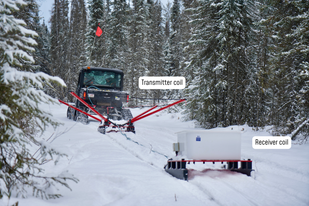
Transient electromagnetic (TEM) methods, also known as time-domain electromagnetics (TDEM), are geophysical methods used to “see” below the ground without digging. They work by sending a quick electromagnetic pulse into the earth using a transmitter loop, then measuring how the resulting signal fades over time with a receiver. Different materials—like water, clay, sand, or rock—respond differently, so by tracking how quickly the signal weakens, changes in subsurface conditions can be mapped.
A range of TEM equipment is available enabling stationary, mobile, and aerial surveys across a variety of terrains.
Why use transient electromagnetic (TEM) methods?
TEM techniques are gaining traction because they offer several key benefits:
- Non-invasive and low impact
TEM surveys do not require drilling or direct contact with the ground, making them ideal for environmentally sensitive or remote areas and challenging terrain. - Fast and efficient coverage
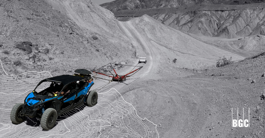
Modern TEM systems can quickly survey large areas—often in hours instead of days—helping reduce project timelines and costs.- A towed TEM (tTEM) system can collect resistivity data at vehicle speeds of up to 20 km/h on open terrain and reach depths of about 100 metres.
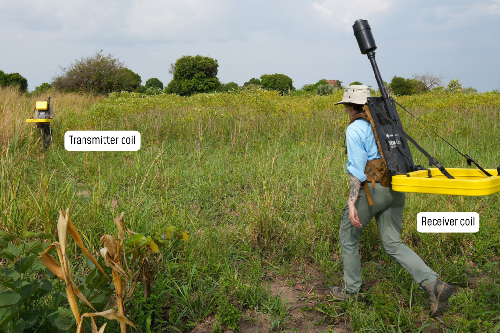
- In rougher terrain, a dual backpack-based system with a combined weight of 25 kilograms can collect data as fast as a two-person crew can walk and reach depths of around 50 metres.
Trusted data, without the wait
For over 30 years, BGC’s geophysics team has been using cable-based electrical resistivity tomography (ERT) in geotechnical investigations, which collects continuous profile data up to 200 metres underground. Today, new TEM systems offer similar insights, only much faster and with investigation depths of up to 100 metres, which is more than sufficient for most investigations.
Lightweight and more-compact rapid-sampling equipment collects equivalent data in a fraction of the time, significantly increasing data collection efficiency.
- Deep subsurface insight
Depending on the system and conditions, TEM surveys can investigate tens-to-hundreds of metres below surface, revealing features that may not be detectable with shallow methods. - Sensitive to key targets
TEM is particularly effective for distinguishing different geological materials, including groundwater and aquifers, clay layers, mineral and aggregate deposits, and contaminants or saline water. - Works in challenging conditions
Unlike other electrical methods, TEM performs well in areas with highly resistive surface layers (e.g., sand, gravel, bedrock) because it does not rely on direct electrical contact with the ground.
What is transient electromagnetic (TEM) surveying used for?
Common TEM applications include:
- Groundwater and aquifer mapping
- Geological mapping
- Environmental investigations such as contamination studies
- Mineral and mining exploration
Since 2022, BGC’s geophysics team has been supporting TEM system testing and development for site investigations across Canada, the U.S., and Africa. Explore some of BGC’s TEM system applications below.
Mining and site investigations in British Columbia
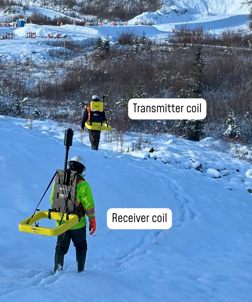
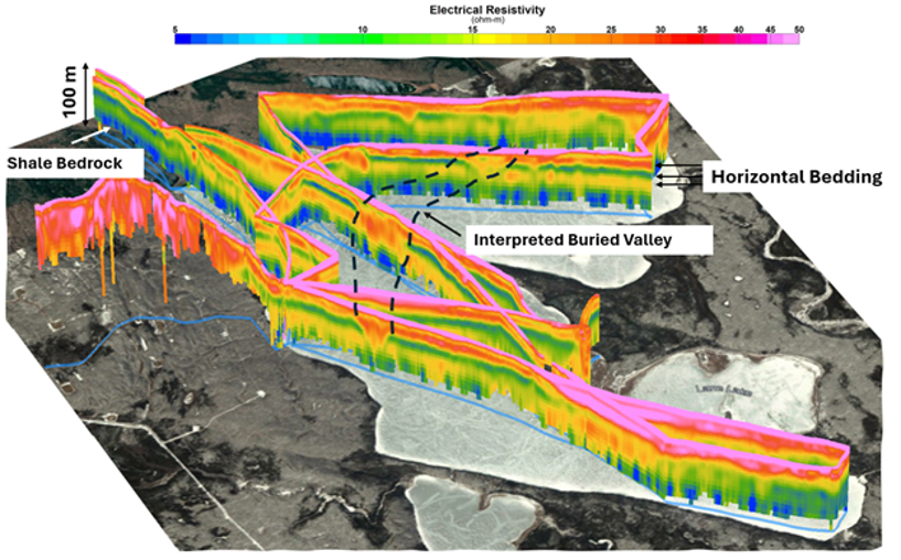
In a recent pilot project at a mine site in northern British Columbia, Canada, BGC used a backpack-based TEM system to map out hydrostratigraphic units 50 metres below ground to reveal how groundwater in the area is stored, moves, and can be extracted. The survey was completed in harsh winter conditions over rough terrain, capturing data in a fraction of the time that would have been required if a more traditional ERT survey was used.
When combined with borehole data, this information helped us better understand the thickness and extent of different geological layers in the area, allowing us to develop a groundwater model to safely manage mine tailings and waste material.
Groundwater exploration in Africa
In early 2026, through our social impact program BGC Squared, BGC geophysicists used TEM systems on two groundwater exploration projects in Africa to aid local communities in locating safe, clean, and reliable drinking water sources.
Eastern Chad
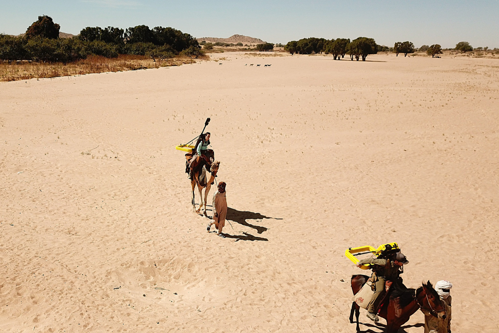
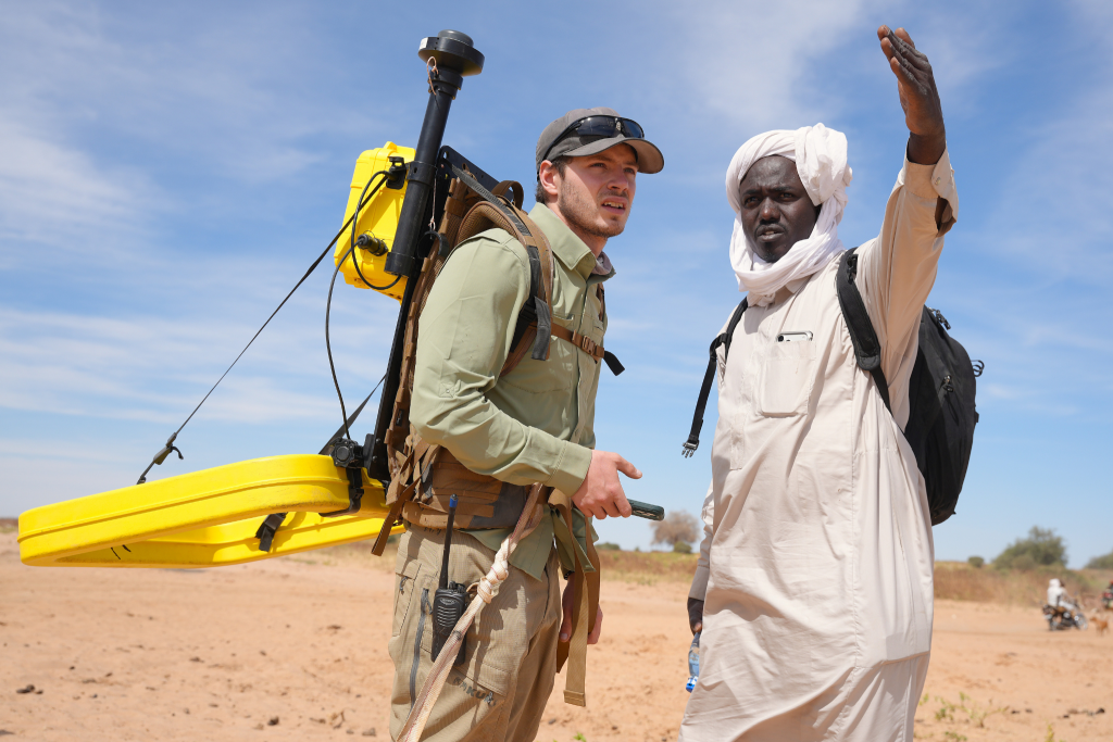
Working with the United Nations High Commission for Refugees (UNHCR), BGC Squared collected 227 km of TEM data in and around refugee camps in eastern Chad, where hundreds of thousands of people had fled war in neighbouring Sudan. Due to the large search areas, the TEM system provided a major advantage over cable-based ERT surveys, which were used in a previous exploration project in 2024. Combined results from the ERT and TEM surveys have now been used to site ten high-producing water wells, providing some relief to refugee communities.
Northern Uganda
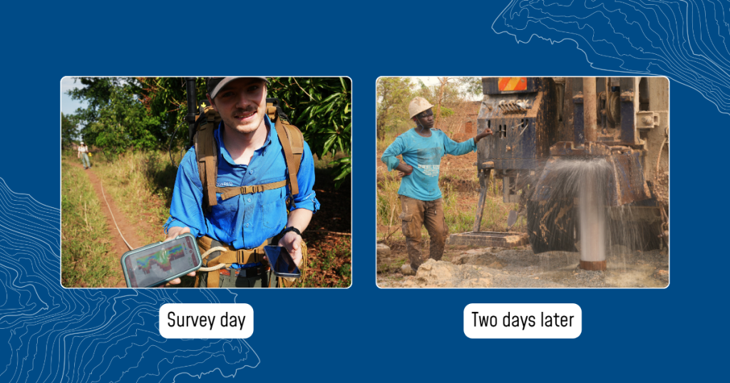
In partnership with IsraAID, our BGC Squared team also used TEM surveys to identify potential groundwater zones near rural villages in Acholiland, northern Uganda. The data generated helped highlight areas of deeply weathered bedrock more likely to produce sustainable water supplies for community wells. Based on these results, three drilling targets were selected, resulting in three successful water well installations with enough sustainable potable water for each rural village.
Turning data into decisions
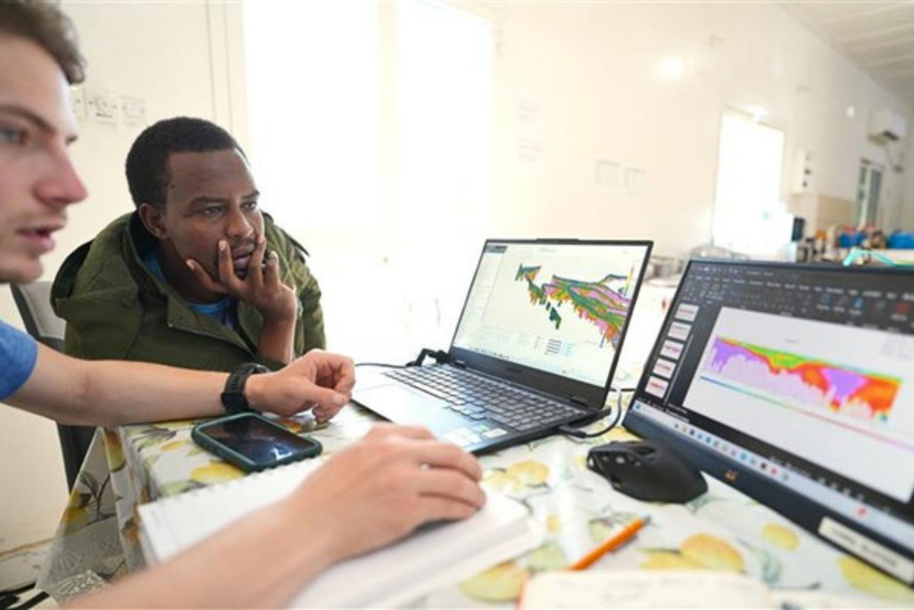
At BGC, we understand how challenging it can be to bring together and interpret the many types of data collected during a site investigation, including:
- Boreholes and test pits
- Groundwater and water chemistry data
- Hydraulic conductivity measurements
- Topography and high-resolution imagery
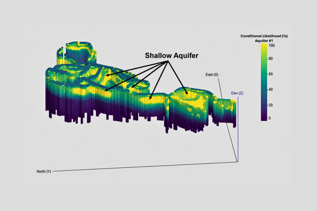
Geophysical surveys provide a framework to connect these datasets into a coherent understanding of the subsurface, provided the data is high-quality and fit for purpose. Our team routinely collects and interprets a broad range of geophysical data to support accurate site models.
As data volumes grow, BGC is moving beyond traditional cross-sections and toward integrated 3D models. Our in-house geostatistical approaches combine advanced analytics with experience from our specialized engineers, geoscientists, and geophysicists to produce reliable, decision-ready insights.
This is where TEM and other geophysical methods become more than a survey—they become tools for better decision-making.
Partner with BGC for TEM surveys and other geophysical services
For over 30 years, our in-house geophysics team has been specializing in a range of geophysical services, including:
- Electrical Resistivity (ERT and 1D soundings)
- Electromagnetic Transient (TEM) Systems (towed and backpack-based)
- Fixed Frequency EM Systems
- Seismic Refraction Tomography (SRT)
- Multichannel Analysis of Surface Waves (MASW)
- Downhole Seismic Testing
- Ground Penetrating Radar (GPR)
- Passive Seismic (HVSR)
- Magnetics (ground or UAV based)
- Seismic Reflection
- Downhole Geophysical Logging
- UAV Photogrammetry and Multispectral Analysis
If your project involves uncertain ground conditions, employing geophysics can help reduce risk and improve outcomes. Whether it’s transient electromagnetic (TEM) surveys or another method, BGC will work with you to select an approach aligned with your objectives, schedule, and budget.
Reach out to our team today and learn how we can help you better understand what’s beneath your project.
Let's talk

Erin Ernst
Senior Geoscientist, Geophysics Team Lead
eernst@bgcengineering.ca

Alastair McClymont
Principal Geophysicist
amcclymont@bgcengineering.ca

Paul Bauman
Principal Geophysicist/Geological Engineer
pbauman@bgcengineering.ca